
What’s with all the wild weather this week?
From blizzard conditions in the Midwest to a heat wave in the western U.S. to flooding in Hawaii, March has brought wild weather to the country

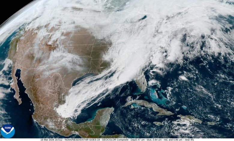
A low-pressure system was bringing snow to the Midwest and stormy conditions to the eastern U.S. on Monday.
Torrential rains have brought flash floods to Hawaii. Parts of the upper Midwest are blanketed in more than two feet of snow, with flakes still falling. Hail, strong winds and tornadoes threaten the eastern U.S. And the West is in for record-shattering heat. Why is all the weather seemingly happening right now?
The short answer: it’s March. Early spring is a transitional time of year, weather-wise. Cold air from the north lingers even as warm, moist air pushes up from the south, leading to collisions over the contiguous U.S. that set up prime conditions for unsettled weather and blockbuster snowstorms. “March and April are the time of year we get these clashes in air masses,” says Brian Hurley, a meteorologist with the National Weather Service’s (NWS’s) Weather Prediction Center.
Let’s dig into the details a little more, starting with the snow in the Midwest. A storm, or low-pressure system, developed over the area, with cold air coming down from Canada meeting moist air streaming up from the Gulf of Mexico. That means the storm “has a lot of moisture to work with,” Hurley says, so snowfall totals are high. The snow is also very wet compared with what typically falls in the region in January or February. This is fairly normal for March and April snows there, Hurley says. But because this storm is fairly strong, it is bringing blizzard conditions and snowfall rates of up to three to four inches per hour in some places. Certain spots could see record-setting snowfalls for this time of year.
On supporting science journalism
If you’re enjoying this article, consider supporting our award-winning journalism by subscribing. By purchasing a subscription you are helping to ensure the future of impactful stories about the discoveries and ideas shaping our world today.
Next up, the low-pressure system has a feature associated with it that, in meteorology speak, is called a QLCS, or quasi-linear convective system. Basically, this means a long, wavy line of thunderstorms—which can be seen trailing down from the low-pressure area in a classic comma shape on weather maps. The waves happen when “winds are gusting out faster” ahead of the main line, Hurley says, an arrangement that looks like a bow pulled taut. The wind happens because of large pressure differences, and in this case, it could gust up to 60 to 70 miles per hour in parts of the mid-Atlantic on Monday. Abundant moisture makes for an unstable atmosphere that will cause thunderstorms to develop and that, along with the strong winds, could create tornadoes.
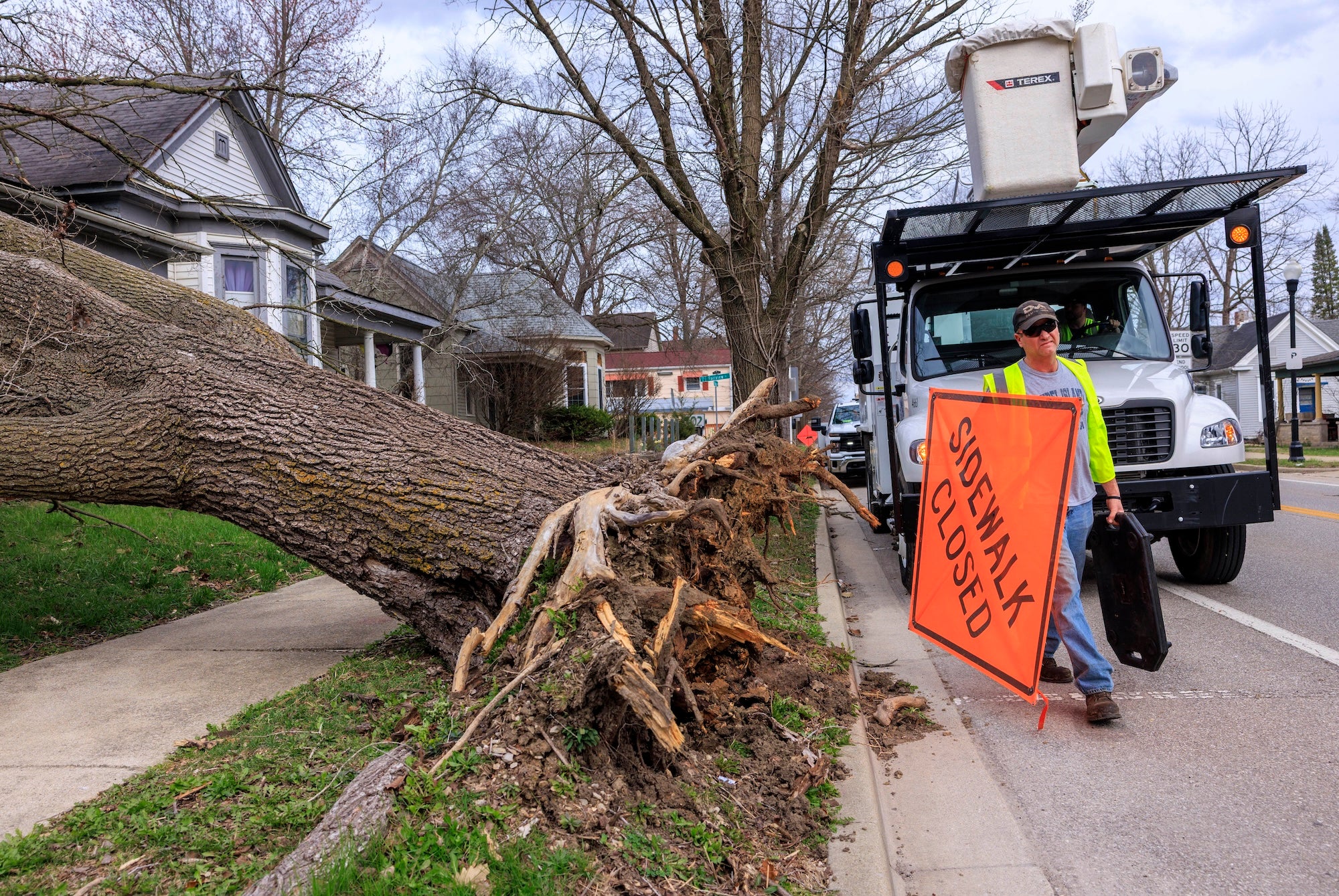
A city worker closes a sidewalk after strong winds toppled a tree onto a house on March 15, 2026, in Bloomington, Ind.
Jeremy Hogan/Getty Images
Now let’s move westward. Upstream of a low-pressure area, you’ll find a high-pressure one, which is exactly what is set to settle and strengthen over the Southwest this week. That will usher in a major heat wave that is expected to send temperatures soaring well above 100 degrees Fahrenheit (38 degrees Celsius) in some places. This also happens in the summer and is often called a heat dome—temperatures won’t get as high as they would if this was, say, July “but are very warm compared to what [they] should be,” Hurley says. The heat wave could set all-time March records unusually early in the month.
Moving westward and further upstream again, on the other side of the high-pressure system is another low-pressure area. This one, called a “Kona low,” brings southerly winds “that draw a lot of deep moisture up over the islands,” says Thomas Vaughan, a meteorologist at the NWS’s office in Honolulu. The Hawaiian Islands typically see a few of these systems a year, he says, but this one was intense. Several places saw rainfall totals of 15 or more inches over five days, which led to flash flooding and mudslides. Those rains “far surpassed normal rainfall values for the entire month of March,” Vaughan says. Further rain is expected this week, although not on the same scale, he adds.
It’s Time to Stand Up for Science
If you enjoyed this article, I’d like to ask for your support. Scientific American has served as an advocate for science and industry for 180 years, and right now may be the most critical moment in that two-century history.
I’ve been a Scientific American subscriber since I was 12 years old, and it helped shape the way I look at the world. SciAm always educates and delights me, and inspires a sense of awe for our vast, beautiful universe. I hope it does that for you, too.
If you subscribe to Scientific American, you help ensure that our coverage is centered on meaningful research and discovery; that we have the resources to report on the decisions that threaten labs across the U.S.; and that we support both budding and working scientists at a time when the value of science itself too often goes unrecognized.
In return, you get essential news, captivating podcasts, brilliant infographics, can’t-miss newsletters, must-watch videos, challenging games, and the science world’s best writing and reporting. You can even gift someone a subscription.
There has never been a more important time for us to stand up and show why science matters. I hope you’ll support us in that mission.