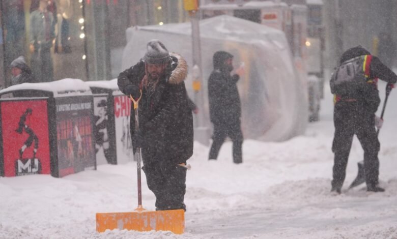
A massive winter storm dumped sleet, freezing rain and snow across much of the U.S. on Sunday, bringing subzero temperatures and halting air and road traffic.
The ice and snowfall were expected to continue into Monday followed by very low temperatures which could cause “dangerous travel and infrastructure impacts” for days, the National Weather Service said.
The storm totals were quite impressive, but performed exceptionally close to forecasts. Some light freezing rain will create a light glaze overnight in some areas, making driving even more difficult Monday morning. Roads and sidewalks will continue to be very slick, as well.

New York City saw just over 10 inches, while higher totals could be found in the Hudson Valley, Connecticut and the northernmost areas of New Jersey. South of the city, totals were lower, as the snow changed over to sleet and freezing rain earlier in the day.
On the Upper East Side, January Cotrel enjoyed the fresh snow on a block that always closes during snowstorms for residents to sled, throw snowballs and make snowmen.
“I pray for two feet every time we get a snowstorm. I want as much as we can get,” she said. “Let the city just shut down for a day and it’s beautiful, and then we can get back to life.”
Further upstate, New York communities near the Canadian border saw record-breaking subzero temperatures, with Watertown registering minus 34 degrees Fahrenheit and Copenhagen minus 49, Gov. Kathy Hochul said.
The dangerously cold weather was just as big of a concern as the snow.
Mayor Zohran Mamdani said earlier on Sunday that at least five people who died were found outside as temperatures plunged the day before, though the cause of their deaths remained under investigation. He urged people to stay inside and off the roads: “We want every single New Yorker to make it through this storm.”
Travel was, at best, heavily impacted, and at worst was brought to a standstill. More than 11,400 flights were canceled Sunday, according to flight-tracking site FlightAware. Aviation analytics firm Cirium said that as of Sunday morning, the storm is the highest experienced cancellation event since the pandemic.
At LaGuardia Airport, 91% of flights (436 flights) were canceled. John F. Kennedy International Airport had 466 flights canceled, about 80% of flights, according to FlightAware.
Roads were treacherous, as vehicles all over the tri-state got stuck trying to navigate the slick conditions while plows could only do so much to keep up with all the snow. New York State Police said they responded to 250 crashes, but no deaths were reported.
New Jersey Transit suspended all service on Sunday, and only light rail service looked to be up and running by Monday morning. The transit agency said it would work to gradually ramp up bus service Monday, but not until later in the morning. The same goes for Access Link service.
When NJ Transit rail service would be back up and running, that start time was not clear, but it did not appear likely to be in the morning.
On Monday, the focus will turn to cleanup for many. Scores of school districts will remain closed for the day, but NYC students will have a virtual learning day, much to their (and some parents’) chagrin.
On Monday, we’ll see the “warmest” temperatures over the next several days: in the upper 20s. After Monday, another bitterly cold blast takes over for the remainder of the week.
The cold will be the predominant headline going forward, with high temperatures not projected to rise above freezing in NYC until the middle of next week, meaning most of the snow and ice from Sunday will stick around for quite a while.